tf_geo_rasterize
tf_geo_rasterize
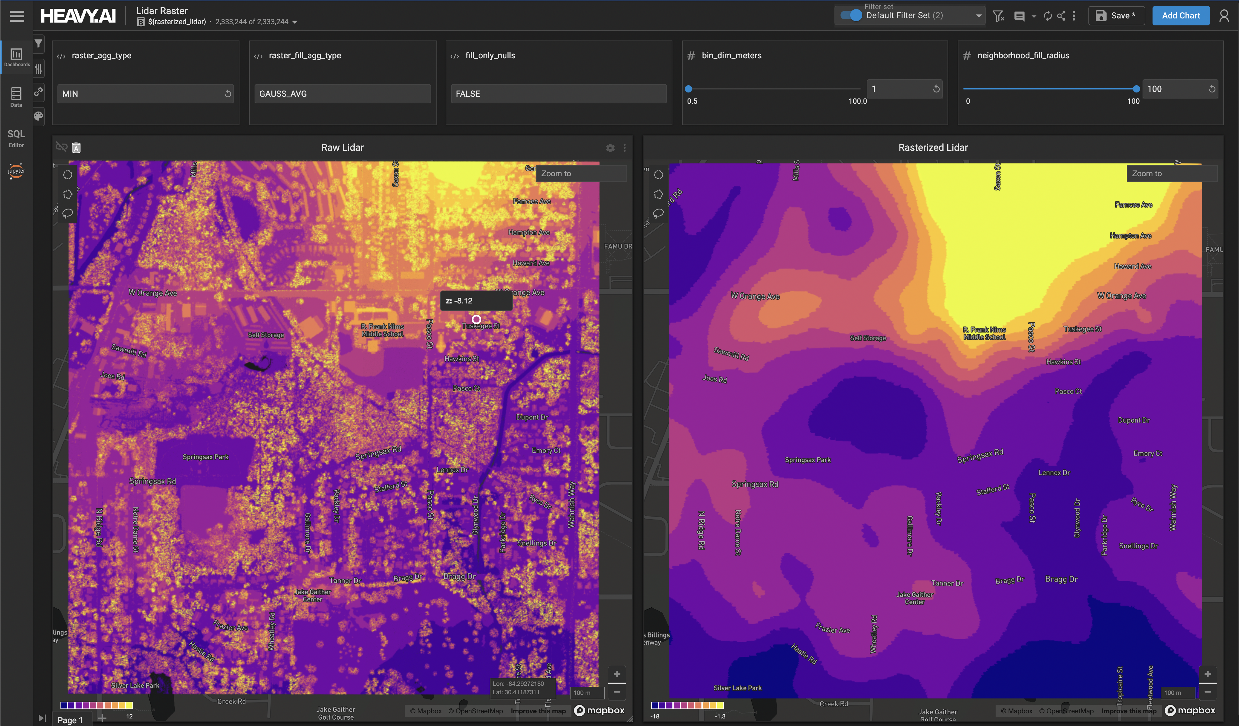
Aggregate point data into x/y bins of a given size in meters to form a dense spatial grid, with taking the maximum z value across all points in each bin as the output value for the bin. The aggregate performed to compute the value for each bin is specified by agg_type, with allowed aggregate types of AVG, COUNT, SUM, MIN, and MAX. If neighborhood_fill_radius is set greater than 0, a blur pass/kernel will be computed on top of the results according to the optionally-specified fill_agg_type, with allowed types of GAUSS_AVG, BOX_AVG, COUNT, SUM, MIN, and MAX (if not specified, defaults to GAUSS_AVG, or a Gaussian-average kernel). if fill_only_nulls is set to true, only null bins from the first aggregate step will have final output values computed from the blur pass, otherwise if false all values will be affected by the blur pass.
Note that the arguments to bound the spatial output grid (x_min, x_max, y_min, y_max) are optional, however either all or none of these arguments must be supplied. If the arguments are not supplied, the bounds of the spatial output grid will be bounded by the x/y range of the input query, and if SQL filters are applied on the output of the tf_geo_rasterize table function, these filters will also constrain the output range.
Input Arguments
Output Columns
Example